

Long before Lake Norman covered thousands of acres of the Carolina Piedmont, the Catawba River flowed untamed through a landscape of farms, forests, and small communities. It was a river that shaped life in North Carolina. Families depended on its waters, mills harnessed its power, and towns grew along its banks.
But the Catawba was also a river to be respected.
Those who lived near it understood that heavy rains could quickly transform the peaceful waterway into a dangerous force. Even so, nothing could have prepared them for the events of July 1916, when the river unleashed a fury unlike anything most residents had ever witnessed.
More than a century later, the Great Flood of 1916 remains one of the most devastating natural disasters in North Carolina history.
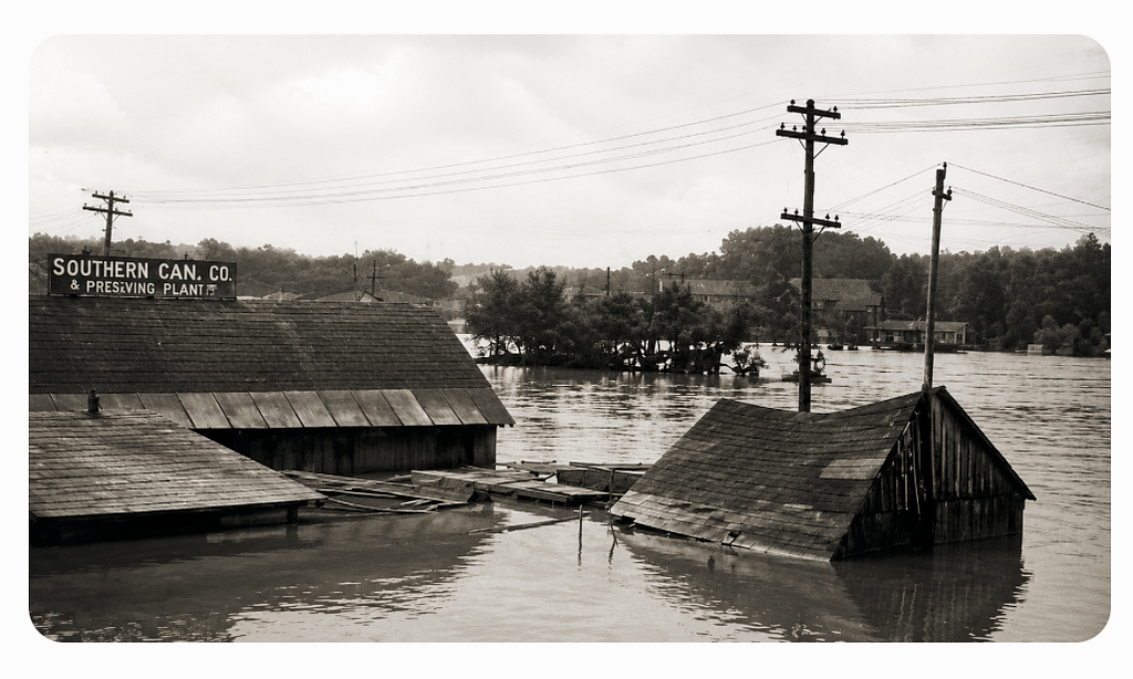
A Summer Like Any Other
The summer of 1916 began much as countless others had before it.
Across Western North Carolina and the Catawba Valley, farmers tended fields of corn, cotton, and vegetables. Mill workers followed familiar routines as textile factories hummed with activity. Children played in dirt streets, and families gathered on front porches during warm evenings to escape the heat of the day.
The nation stood on the edge of great change. The United States had not yet entered World War I. Automobiles were becoming more common, but horses and wagons still filled many roads. Electricity was gradually spreading across the region, though much of rural North Carolina remained without it.
Life moved at a steady pace.
Then the weather began to change.
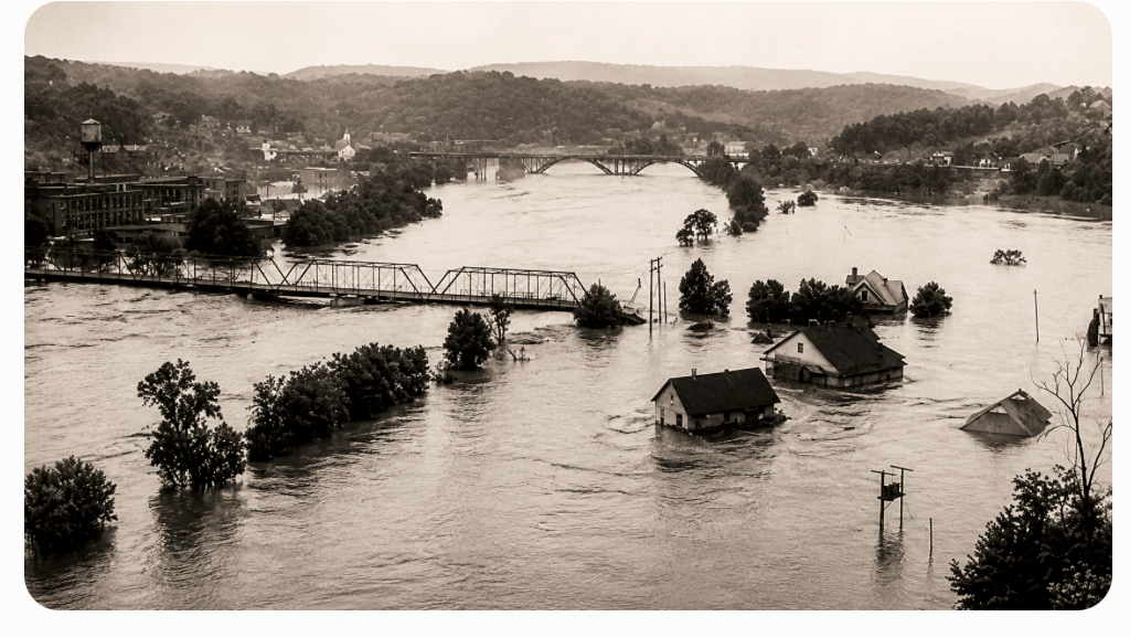
Two Storms, One Disaster
The catastrophe that became known as the Great Flood of 1916 was not caused by a single storm.
In early July, a tropical storm swept through the Southeast, bringing significant rainfall to the mountains of Western North Carolina. Rivers and streams rose, but the damage was relatively limited. More importantly, the storm left the ground saturated and waterways already running high.
Just days later, a second and far more powerful tropical system moved inland from the Gulf Coast and tracked northward into the Southern Appalachians.
As the storm encountered the towering ridges of the Blue Ridge Mountains, moisture-laden air was forced upward, producing extraordinary rainfall. The mountains acted like a barrier, squeezing vast amounts of water from the atmosphere.
For communities across Western North Carolina, the results were catastrophic.
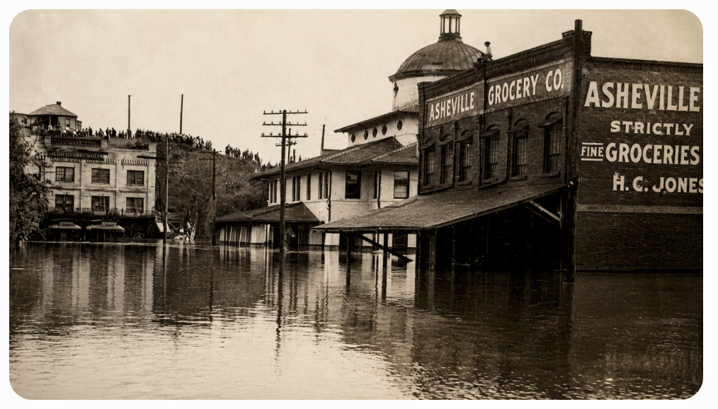
The Skies Open
Rain fell with astonishing intensity.
In parts of the mountains, more than a foot of rain fell in a single day, with some locations receiving considerably more over the course of the storm. Creeks overflowed almost immediately. Small streams became raging torrents. Water rushed down mountain slopes carrying trees, rocks, and debris into larger rivers.
The French Broad, Swannanoa, Linville, Johns, Green, and Catawba river systems all swelled beyond their banks.
As the floodwaters surged eastward, the Catawba River began to rise at an alarming rate. Residents watched in disbelief as the water climbed higher hour after hour. Landmarks that had stood for generations disappeared beneath muddy currents. Fields became lakes. Roads vanished. The familiar river was transforming into something few had ever seen.
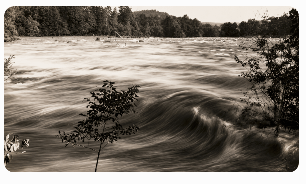
Rainfall Records That Shocked the Nation
The flood was the result of two tropical weather systems striking the region within a short period of time.
The first storm saturated the ground and filled rivers and streams. Before waterways could recover, a second and more powerful storm moved into the Southern Appalachians.
The mountainous terrain amplified the rainfall through a process known as orographic lifting, where moisture-filled air is forced upward by mountain slopes, producing intense precipitation.
Some locations in Western North Carolina received more than 20 inches of rain during the event. Streams and creeks became raging torrents capable of moving trees, boulders, homes, and railroad bridges.
The Catawba Unleashed
By mid-July, the Catawba River had become a roaring torrent.
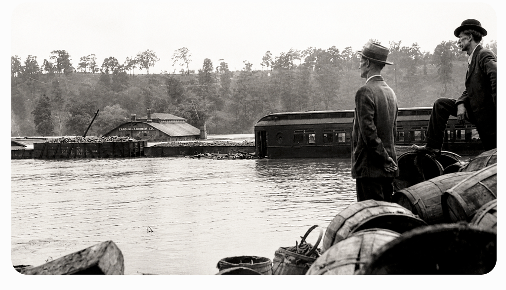
Witnesses described massive trees hurtling downstream. Barns, fences, livestock, and sections of buildings were swept away in the current. The river carried an endless stream of debris as it tore through the valley.
Bridges became focal points for anxious crowds.
Residents gathered to watch the swollen river surge beneath them, often underestimating the danger. Many bridges would not survive. Wooden spans were ripped from their foundations, while steel and iron structures buckled under the tremendous force of the water and debris.
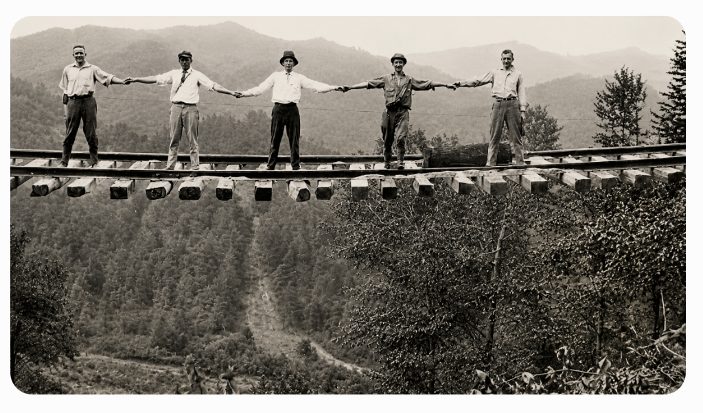
Railroad lines suffered extensive damage throughout Western North Carolina. Tracks were washed away, embankments collapsed, and communities found themselves isolated from the outside world.
Communication systems failed as telegraph and telephone lines were destroyed.
In many areas, people had no way of knowing what was happening beyond their immediate surroundings.
A Night of Fear
For families living near rivers and creeks, the flood brought terrifying uncertainty.
Many awoke during the night to the sound of rushing water. Others heard what survivors later described as a distant roar growing steadily louder. By the time some residents realized the danger, water was already entering their homes.
Families fled to higher ground carrying only what they could manage.
Some escaped through windows. Others climbed to upper floors or rooftops while waiting for help. Neighbors risked their own lives to rescue one another, using boats, ropes, and makeshift rafts whenever possible.
Acts of courage emerged across the region, but so did heartbreaking tragedy.
Lives were lost as floodwaters swept away homes and caught residents by surprise.
Destruction Across the Mountains and Piedmont
The flood left a path of devastation across North Carolina.
Hundreds of bridges were damaged or destroyed. Roads disappeared beneath washouts and landslides. Railroad companies faced enormous losses as miles of track and infrastructure were swept away.
Thousands of acres of farmland were inundated. Crops that represented a year’s income vanished beneath floodwaters. Livestock drowned, and fertile fields were buried beneath layers of sand, gravel, and debris.
Entire communities struggled to recover.
When the waters finally receded, residents emerged to find a landscape forever altered. River channels had shifted. Familiar landmarks were gone. In some places, the destruction was so extensive that people had difficulty recognizing their own property.
The economic impact would be felt for years.
One of North Carolina’s Greatest Natural Disasters – A Disaster That Changed the River
The devastation of 1916 reinforced the need for better management of the Catawba River.
In the decades that followed, hydroelectric development expanded throughout the river basin. A series of dams and reservoirs were constructed to generate electricity, regulate river flows, and provide some degree of flood control.
Many of today’s lakes on the Catawba River—including Lake James, Lake Rhodhiss, Lake Hickory, Lookout Shoals Lake, Mountain Island Lake, and eventually Lake Norman—are part of that system.
While modern reservoirs cannot prevent every flood, they dramatically changed the behavior of the river compared to the untamed Catawba that residents faced in 1916.
In the decades that followed the flood, hydroelectric development expanded throughout the Catawba River basin. Dams and reservoirs transformed the river from a largely free-flowing waterway into a managed system designed to generate electricity, store water, and reduce the impact of flooding.
Among those reservoirs would be Lake Norman, created in 1963 with the completion of Cowans Ford Dam.
Remembering the River Before the Lake
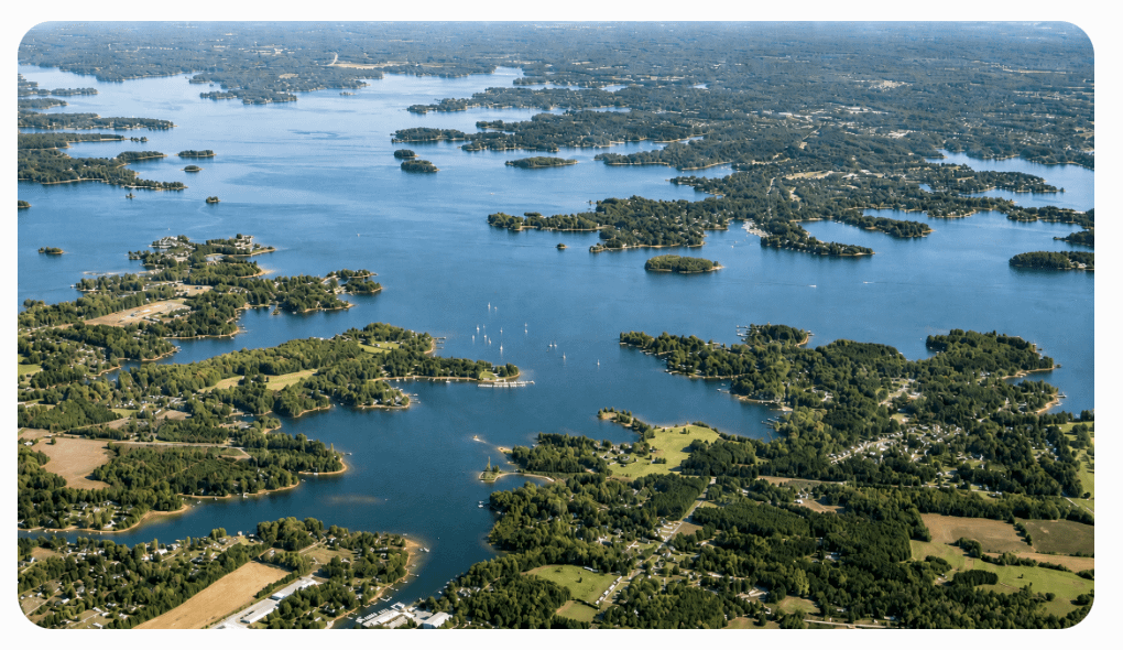
Today, visitors to Lake Norman see a landscape of marinas, waterfront communities, and recreational boating. It is easy to forget that beneath the lake lies the old Catawba River Valley, a place where generations once farmed, worked, worshipped, and built their lives.
Yet the story of the Great Flood of 1916 remains an essential part of that history.
Long before dams regulated the river and long before Lake Norman existed, the people of the Catawba Valley witnessed nature at its most powerful. They saw a river rise beyond imagination and reshape the landscape around them.
More than a century later, the flood stands as a reminder of both the power of the Catawba River and the resilience of the communities that called its banks home.
Duke Energy sought ways to prevent similar disasters while harnessing the immense power of the Catawba River. Leading that effort were engineers James B. Duke and William States Lee, men who believed the river could be controlled and used to benefit the growing region.

Their vision was ambitious.
Over several decades, Duke Power developed a chain of eleven lakes along the Catawba–Wateree river system. Lake Norman, the largest and last lake constructed in that system, was created through the building of Cowans Ford Dam, with construction beginning in 1959 and hydroelectric operations starting in 1963.
The creation of these lakes transformed the region forever. What had once been a dangerous and unpredictable river became a carefully managed hydroelectric system that generated power, provided flood control, supplied water, and created recreational opportunities for generations to come.
Today, Duke Energy’s hydroelectric stations on eleven lakes continue to produce electricity while serving as valuable resources for communities throughout the Catawba River Basin.
The legacy of those engineers and workers extends far beyond power generation. Their efforts helped drive economic growth, support expanding communities, and shape the landscape that residents of the Lake Norman area know today.
The story of Lake Norman did not begin with the lake itself.
It began with a river, a devastating flood, and a determination to ensure that such destruction would never happen again.
Imagine the Flood Today
At its peak, floodwaters swept away bridges, railroad tracks, homes, barns, livestock, and entire sections of road.
Without the modern dam system that now regulates much of the Catawba River, a flood of similar magnitude would have profound impacts on communities throughout the river basin.
The Great Flood of 1916 reminds us that before Lake Norman, before hydroelectric dams, and before modern flood-control systems, the Catawba River was one of the most powerful and unpredictable forces in the Carolinas.
Its legacy still flows beneath the waters of Lake Norman today.
As mentioned, LKNConnect.com aims to report the history of “Life Before The Lake.” We will be researching the past of the towns around the lake and would like to hear from you about your family’s history of the area.

I have lived in Huntersville my entire life. We actually trace my family’s history back for eight generations. When folks hear this, they ask, “What was life like before the lake?” That question inspired me to research the history of the area. This new feature is the result of those questions. I plan to write many articles about “Life Before The Lake” and post them on www.Lknconnect.com’s website.
As mentioned, LKNConnect.com aims to report the history of “Life Before The Lake.” We will be researching the past of the towns around the lake and would like to hear from you about your family’s history of the area. Feel free to contact David Beard at Dbeard@Lknconnect.com.
Sources:
We have attempted to credit all sources for these articles. Much of the information is reported in multiple publications.
Journalist and historian Chuck McShane provided information for this article. Chuck traced the triumphs and troubles of Lake Norman from the region’s colonial beginnings to its modern incarnation.
Information for this, and upcoming articles on LKNConnect.com, comes from Chuck’s book A History of Lake Norman, published by The History Press, Charleston, SC 29403, Copyright, 2014 by Chuck McShane.
Information for this, and upcoming articles on LKNConnect.com, comes from Cindy’s book, Images of America – Around Lake Norman